Do you know the different trail signs at the Alps? I recap all the signs and symbols for each country in the Alps and made a guide about it.
Stretching approximately 1,200 kilometers across eight Alpine countries (France, Switzerland, Monaco, Italy, Liechtenstein, Austria, Germany, and Slovenia), the Alps is one of the most impressive mountain ranges in the world and by far the best destination for adventurers in Europe.
This is not only the place for alpine climbers exploring snowy peaks or rich skiers from all over the world. The Alps offer one of the largest network of hiking routes and trails in the world. From simple walks with the family to high altitude via ferratas (protected climbing routes) made for non-climbers like me.
Furthermore, all hiking, mountain and alpine trails in the Alps feature a standard sign and marking system that is the same wherever you go. This sign can be found all over the eight countries where the Alps are and in this article I want to go more into detail about it.
Read more: How to plan a road trip in the Alps

Hiking Trail difficulty
Yellow, white or magenta arrow signs. Each country has their own pointer design and color. However, when it comes to trail difficulty there is a standard each country has to follow.
Hiking trails
Hiking trails are very accessible trails and perfectly for short and long walks. They demand no special level of fitness and the signalization is either a yellow symbol, or the pointer is yellow.
For these routes the steep sections along the way are mostly upgraded with man-made steps and most areas with any danger of falling are protected by secured hand rails. Additionally, any streams or small rivers on the path can be crossed by bridges.
Mountain trails

Mountain trails are signalized with a white-red-white symbol. These routes vary extensively when it comes to distance or length – from short 2-3 hikes to multiple day routes crossing countries (ex. Liechtensteiner Weg – A mountain trail that crosses entire Liechtenstein in 5 days) and require a certain level of fitness.
These mountain trails are are mostly steep, narrow and can be exposed in certain areas. Additionally, difficult sections are secured with ropes or chains and the trails should be walked using proper footwear.
For traveling a mountain trail is also recommended to have a basic knowledge of the possible dangers in a mountain and consider the weather conditions before starting a route. Some mountain hikes won’t be accessible when there is snow or heavy rain.
Alpine routes

These challenging trails are signalized with a white-blue-white symbol. They require a very high level of fitness and, at some point, experience in climbing and mountaineering. Alpine routes can pass across dangerous areas like glaciers and rockfall zones.
Alpine routes are also very exposed in certain areas and can’t be accessed without proper equipment or a guide. Some standard accessories a climber needs for an alpine route are a compass, ropes, pick axe, harnesses and sometimes an altimeter.
But don’t worry. Alpine routes only make less than 1% of all the hiking routes in the alps and you will very rarely encounter one.
NOTE: During winter you might also encounter a full magenta sign. These are signs marking exclusively winter walking trails.
How to read hiking signs
Apart from the level of difficulty, other information you will find on a hiking sign at the Alps is the final destination of the route, distance (either in km or hours), facilities along the way and direction of it.
Moreover, you will also find intermediate marks along the way that will help you reassure that you are following the right track. These marks can be direction pointers with the route number or name, confirmations with the correspondently hiking trail difficulty or signs with an arrow pointing the correct direction.
Read more: Exploring the Ice Caves of Austria
Read more: The Liechtenstein Trail: Hiking Across The World’s Sixth-Smallest Nation
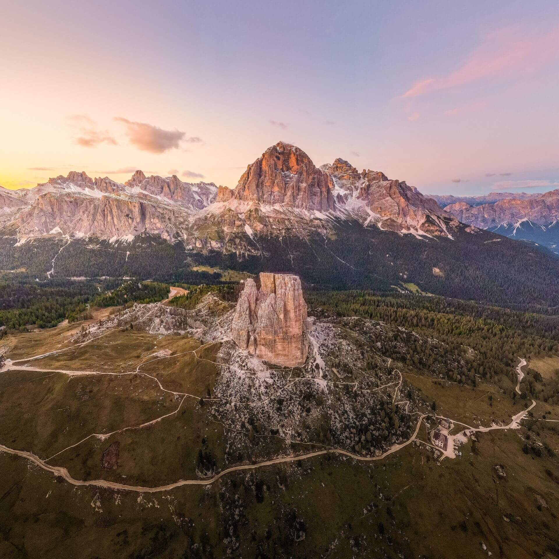
Read more: Which are the best activities in the Dolomites

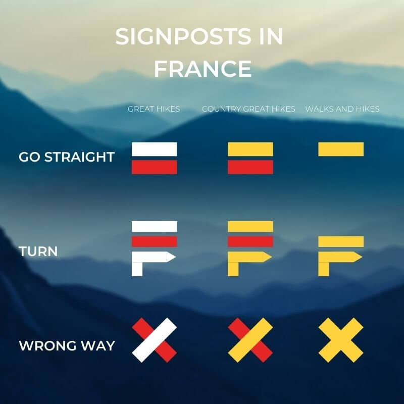
Additional signs in different countries
Each country where the Alps are located has a different topography and different set of basic rules for hiking. For that reason some of them might have some additional signs that might be confusing on the first sight.
France is a good example of it. They don’t only use the standard system to state the difficulty of a route, but they also use other symbols to keep the hiker more aware of the situation around him.
Read more: Road trip in the Alps – Driving through the High Alpine Road of Austria
Easy tips for your first hike
- Do not overestimate the level of fitness you’re capable of.
- Do not underestimate trails and weather conditions. Ask at the hotel staff or a tourism office if the route is accessible once weather changes.
- Never leave the marked route. That is why there are several signposts or route signs on rocks, fences, etc.
- Treat nature respectfully. Avoid taking any souvenirs from nature back home and take an extra bag with you for the trash you generate along the way.
- Inform yourself about the length of the route beforehand, which scenic stops you might encounter along and how long this route might take you to finish.
Read more: Which are the best mountain landscapes in Europe
Read more: What is the most difficult hike in the Dolomites

Hiking is one of the best activities to do outdoors. It is fun, you get the chance to see and experience wonderful scenery and it can be easily combined with other sports such as climbing, kayaking or cycling. The Alps is also one of the best places in the world to do this and with connections from all over Europe in less than 3 hours to some city next to the Alps, this is one of these places that each one of us should at least see once in a lifetime.
Read more: Interrail Tips – How to make the most of your interrail experience
Read more: Exploring the Alta Via 1 – Dolomites most beautiful hiking route