Green and wild instead of grey and futuristic, Mt.Takao and Mt. Mitake are the best hiking routes near Tokyo and a great alternative to try something new.
Hectic, chaotic and sometimes extremely crowded, Tokyo can be a little bit overwhelming for a first time visitor. But don’t worry, the scenic hiking routes at Mt. Takao and Mt. Mitake will take your breath away. . Either you want to escape the Japanese capital for the weekend or get in touch with nature and stretch your legs out, these are great choices for you to go out.
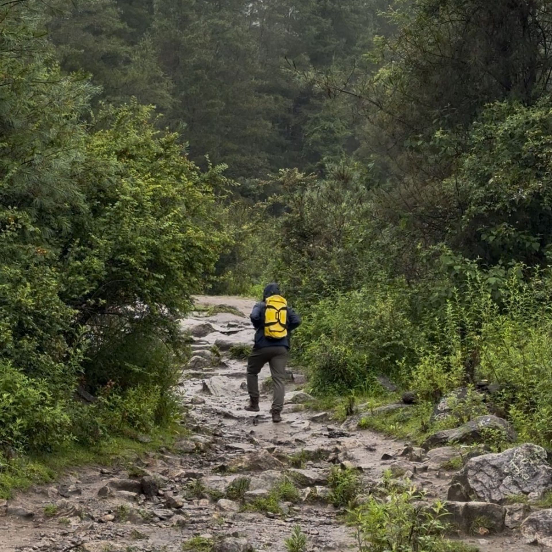
Many people don’t think about hiking when they think about Japan, but there are a lot of incredible hiking trails for you to visit. Mt. Takao and Mitake are the two most popular ones to enjoy outside Tokyo. If you want to get some exercise and immerse yourself in nature, you will love any of these hiking routes outside Toyko.
Do you need internet in Japan? I recommend the Japan of Flexiroam or the Japan Plan of Airalo. You can get 10 GB of internet for just 15 USD
Read more: Which is the best e-SIM to use in Japan
Hiking routes at Mt. Takao
Takao is one of the most popular hiking spots to head to for people that want to get out of the city for a hike. Mt. Takao can be reached in about an hour by train from central Tokyo. Since it was selected as a 3-star tourist destination by the “Michelin Green Guide Japan” in 2009, many tourists from overseas also come to visit.
There are different hiking routes outside Tokyo, some for casual hikers and some for experienced hikers. Even the trails for experienced hikers aren’t very difficult and if you don’t want to bump into people all the time and don’t mind taking on a little challenge, then you might want to take this route.
There are plenty of sightseeing spots such as delicious gourmet food and Japanese “power spots”.The view from the top of the mountain is spectacular. There are many teahouses scattered along the way to the power spot “Takaoyama Yakuoin,” and there are many speciality gourmet foods such as dumplings and Tororo soba. In the summer, the beer garden with a spectacular view is also very popular!
Read more: These are the world’s rarest and most unusual passports
Access
Take the Keio Line or JR Chuo Line from Shinjuku Station and arrive in about an hour. Please get off at Keio Line “Takao Yamaguchi” station or JR “Takao” station.
Access by car is via the Chuo Expressway Hachioji JCT, get off at the Takayama Interchange on the Ken-O Expressway, and take Route 20 towards Shinjuku for about 5 minutes to reach Mount Takao.
Overview of the hiking routes in Mt. Takao
There are 7 routes, 1 to 6 and Mt. Inari on the trails of Mt. Takao.
| Route | Route Name | Distance | Time | Difficulty (1: easiest, 5: hardest) |
| 1 | Omotesando Trail | 3.8km | Up: 100 min Down: 80 min | 2 |
| 2 | Kasumidai Loop Trail | 900m | One loop: 40 min | 1 |
| 3 | Katsura Forest Trail | 2.4km | Up: 60 min Down: 50 min | 2 |
| 4 | Suspension Bridge Trail | 1.5km | Up: 50 min Down: 40 min | 2 |
| 5 | Summit Loop Trail | 900m | One loop: 30 min | 1 |
| 6 | Biwa Waterfall Trail | 3.3km | Up: 100 min Down: 80 min | 3 |
| 7 | Inariyama Trail (Ridgeline Trail) | 3.1km | Up: 100 minDown: 80 min | 4 |
| 8 | Takao-Jinma Trail | 15.3km | One way: 5hrs 20 mins | 5 |
You can find more information about the routes HERE
Here is some more information about the hiking routes outside Toyko. Let’s start with the easiest hike to the most difficult hike.
Route 1: Omotesando Trail: The most popular route
Route 1 is the course with the most tourists, and it is the easiest because the road leading to Yakuoin is paved. You can even wear casual clothes and sneakers, without worrying too much about proper hiking equipment, so even beginners can use this route. If you just want to quickly get up the mountain, you can also use Takayama station to get up the mountain in a cable car. If you walk from the foot of the mountain, you can enjoy the view towards the city centre from the Konpira Shrine on the way.
There are many attractions on the course such as monkey gardens, cedar trees, Yakuoin, and there are many restaurants and teahouses. You can rest assured that there are several toilets for you to use.
Route 3- Katsura Forest Trail: A quiet course where you can enjoy the mountains
In front of Yakuo-in Temple, you can climb the southern slope of Mt. Takao using Route 3 from the left side of Jōshinmon on Route 1. The total length is about 2.4km and it takes about 1 hour. The road is clear. Although it is a short route overall, it is not crowded and you can quietly hike along this mountain hiking path. It is perfect for those who want to avoid the hustle and bustle. You may hear the sound of the drums coming from the temple as you proceed directly below Yakuouin.
On the way, there is an observation spot of a V-shaped valley overlooking the city centre. There is also a spot near the top of the mountain where you can see the wig trees.
Route 4- Suspension bridge Trail: A course where you can enjoy the sound of nature
Contrary to Route 3, this course enters the Shinshin Gate on Route 1 to the right and you climb the northern slope of Mt. Takao. A suspension bridge called “Miyama Bridge” is built along the course, and it is the main attraction of Route 4. You can see beech and maple near the suspension bridge, and you will be fascinated by the changing scenery of the four seasons as well as the autumn colours. Since the suspension bridge is popular, it is a course with many hikers.
With the theme of “forest and animals”, there are commentary boards where you can learn about the ecology of animals, and you can learn about them while hiking.
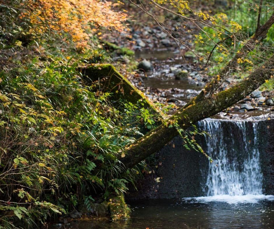
Route No. 6 – Biwa Waterfall Trail: Where you can enjoy the full experience of mountain walking
Route 6 is an amazing course where you walk along the river. You walk through the trees for most of this route, but don’t worry, the road is clear. However, it is recommended to wear proper mountain climbing shoes instead of leather shoes or sneakers as the paved road is up to the first 10 minutes or so, with a lot of stairs, and there are some roads that are difficult to walk.
Biwa Waterfall in the first half of the course is one of the training areas of Yakuoin, and you can experience waterfall training if you apply in advance! Walk along the river to the area directly below the summit.
Route 2- Kasumidai Loop Trail: Enjoy the nature
If you want to enjoy more of the natural beauty of Mt. Takao, Route 2 is great for you. This is a loop route that loops back around, so you can combine this route with Routes 1, 3, 4, and 6.
It is a loop route that circles around Route 1 from Kasumidai Observatory to Jyoshinmon, the middle point of Omotesando leading to Yakuoin. The total length is 900 m, and it takes about 40 minutes to complete the route. You can take a quiet stroll along the gentle road with few ups and downs. About 60 monkeys can be seen in “Saruen”, which is located surrounded by Route 2. It is a popular spot for families.
Route 5- Summit Loop Trail: Meet the oldest forest of Mt. Takao
Route 5 is a course that goes around under the mountaintop. It is connected to all the courses except Route 2, which runs around the hillside, and is also used as a transit route between courses.
On the southern slope, there is vegetation called “Shimobashira”, a plant which you can see the Japanese “ice flower” phenomenon. It is where ice gathers from the stems in winter. On the north side of the course, you can see “Egawa Sugi”, the oldest forest of Mt. Takao.
Route 7- Inariyama Trail: Stretch your legs
“Inariyama Trail” is a course that is tougher than the others. This course is ideal for those who want to feel good walking or beginners who want to step up. If you choose Route 6 for the return route and combine the Inariyama course with Route 6, you will get a good amount of exercise and enjoy your journey.
Route 8- Takao-Jinma Trail: Get a good amount of exercise
Takao-Jinma Trail is a course that starts from the left side of Kiyotaki Station, a cable car at the foot of Oyama, and climbs a ridge that is different from the main ridge of Mt. Takao. It can be said that this is the most difficult and definitely the longest course in Mt. Takao. There are not a lot of ups and downs. Along the way, you can see a wonderful view of downtown Tokyo from the mountain of Inariyama. Just like Route 6, you will come across 200 stairs.
Mt. Takao is a mountain that is great for hikers of all levels. There are all of these different courses, viewpoints, sights, historical structures and natural beauty, all with individual characteristics, so it is a mountain that you can enjoy and visit again and again. After a day of sweating and sore muscles, you can also enjoy the many onsen spots at the foot of the mountain, to bathe and relax in.
Hiking routes at Mt. Mitake
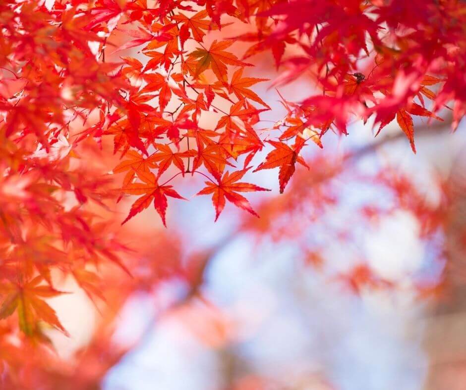
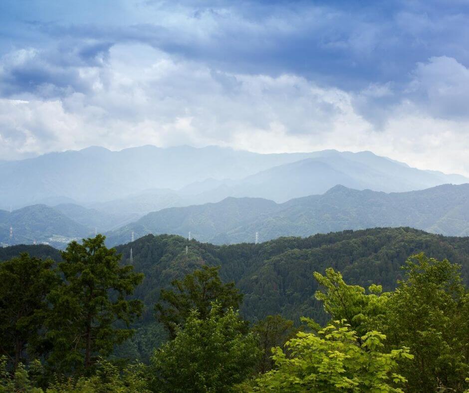
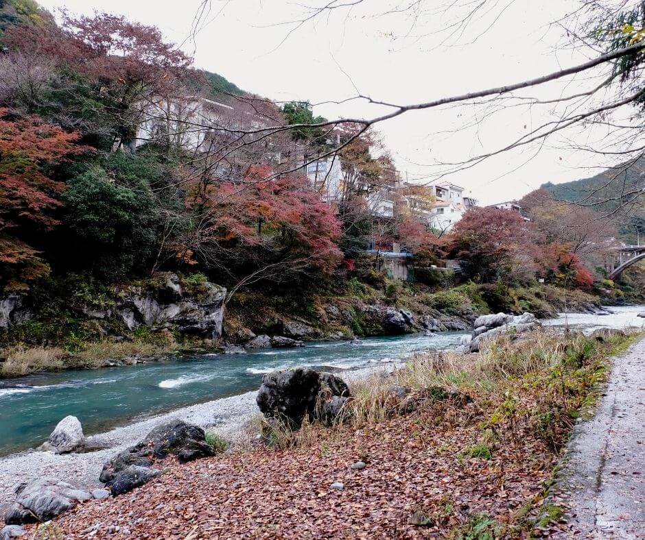
You can find Mt Mitake in the Okutama area, a great area for nature-lovers who want to explore their hiking options. Nature here is unspoiled and it’s especially beautiful during autumn with the autumn leaves.
This popular hiking trail takes around 4 hours, taking you from the Cable Car Mitakesan Station, around the area, and back at the station. Along the way, you will find Musashi Mitake Shrine, multiple waterfalls and a rock garden. Since you will be coming across wet grounds and slippery rocks, make sure to wear proper hiking shoes and gear.
Mt. Mitake is a mountain of worship that has been revered as a sacred mountain since ancient times. Mt. Mitake is also known as a treasure trove of wild birds, insects, and plants.
Feel the breath of life and enjoy fresh greenery in Spring. Go to the rock garden where you can see the clear stream flowing through the mossy rocks in Summer. See the changes of nature in Autimm and enjoy the cold and clear clear night during Winter. This is a place to explore the rich nature of the region throughout the four seasons.
There is only one main hiking trail here at Mt. Mitake and even though this hiking route is not as popular as Mt Takao, you can still inmerse in the nature of the region and explore a wilder side of Tokyo. If you want to escape from other crowds, hikers and the city, come here on weekdays or early in the morning to immerse yourself in nature.
Read more: How many passport pages do you need to travel in Japan
Access
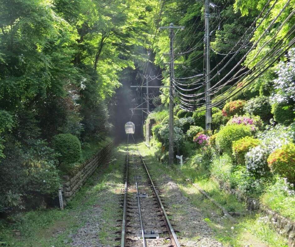
To get to the starting point of this hike, take the 10-minute local bus from Mitake Station to the “Cable Shimo” bus stop. From the bus stop, walk up the slope for 5 minutes to Takimoto Station, the cable car stop. Take the cable car to get to Mitakeyama Station.
Route
When you get off the cable car at Mitakeyama station, there is a souvenir square called Mitakedaira in front of you. Here, you can find souvenir shops and restaurants. In addition, there is a lotus fodder cluster that is said to be the best in Japan. It is free to visit and it is popular with many people visiting during August.
The Mitake Visitor Center is about 10 minutes walk away from the cable car Mitakeyama Station. The visitor centre is a facility to introduce visitors to the nature of the area. There are commentators who provide information on the nature and history of Mt. Mitake and the relationship between people and nature through exhibits, explanations, and various programs.
About 5 minutes from the Mitake Visitor Center, you will arrive at Musashi Mitake Shrine on the summit of Mt. Mitake. There is an amazing view for you to enjoy here. There is a shortcut to the Nagao Square before you reach the shrine, but since you’ve come all the way, let’s enjoy the experience here all the way.
Read more: Useful tips before traveling to Tokyo
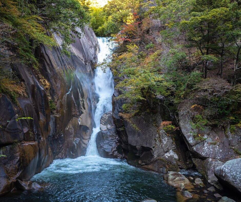
It takes about 20 minutes to arrive at Nanada Waterfall. Nanada Waterfall is a collection of eight large and small waterfalls with a head of 50m, and you can see the fourth stage from the bottom. It is a place that is cool and relaxing in summer.
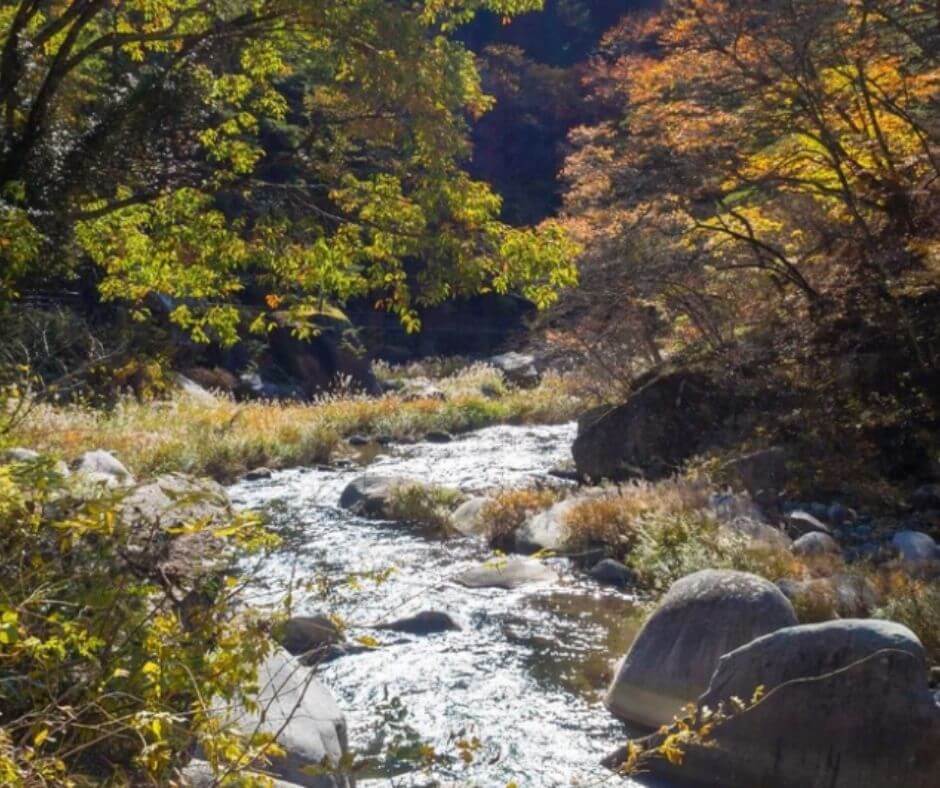
The rock garden is ahead from Waterfall. About 1.5 km from here to Ayahiro Waterfall, there are various rocks of various sizes, and the scenery of a clear stream weaving between mossy rocks invites visitors to a completely different world. If you walk through the rock garden for about 20 minutes while crossing the stepping stones in the clear stream, there is a rest area and a restroom.
A little further from the rest area, you will see the waterfall of Ayahiro. It is a waterfall with a drop of 10m and is used for the waterfall of Musashi Mitake Shrine. If you want to learn more and fully experience this waterfall, check out one of the waterfall experiences run by the local organisation of Mt. Mitake.
Both Mt. Takao and Mt. Mitake have a lot to offer and by experiencing the gorgeous hiking trails here, you can truly dive deep into the beauty of Japanese history, traditions, culture and nature.
Read more: Exploring alternative Tokyo’s cuisine
About the author: Venese is the Founder and Director of FLIP Guide, a Japan guide to help you navigate the ins and outs of Japanese travel, living, culture, and language. She started out as an event organizer and marketing manager, creating unique memories for thousands of people. It’s her mission to bring the most unforgettable experiences to you!